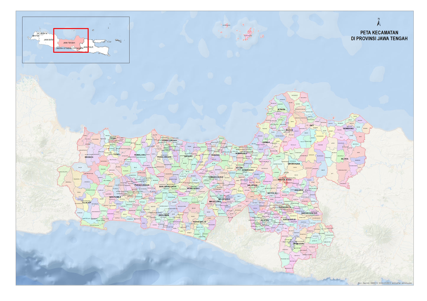
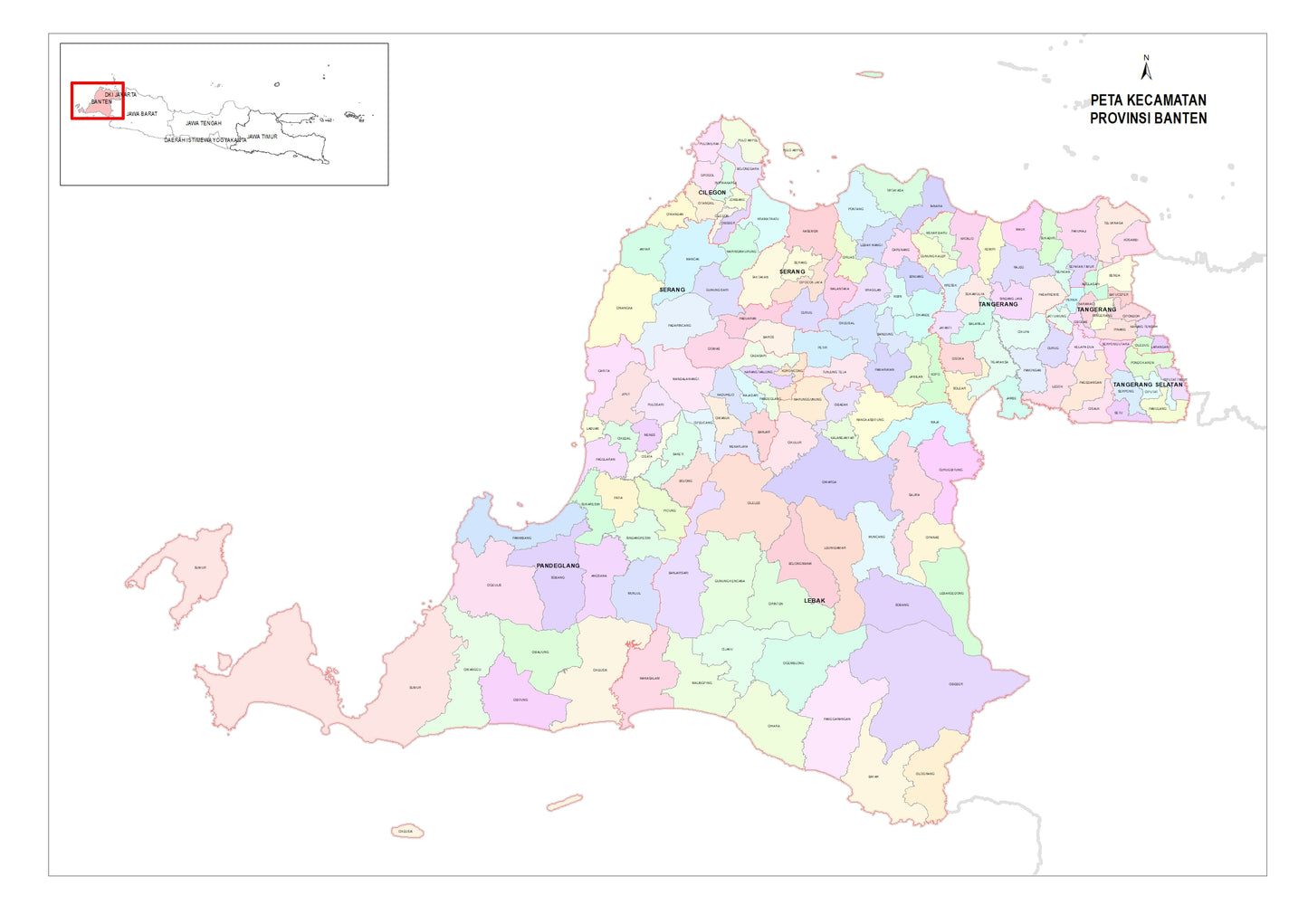
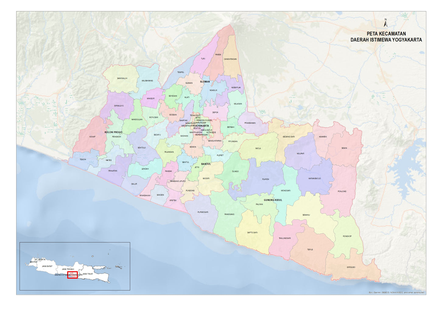
Enhance your geographic insights with our high-resolution A2 PDF map of district boundaries in Java, Indonesia. Designed with precision and clarity, this map provides a detailed overview of each province’s administrative divisions, making it a valuable resource for researchers, government agencies, businesses, and map enthusiasts.
Key Features:
✅ High-Resolution Quality – Crisp and detailed, ensuring clarity when zooming in or printing. ✅ District-Level Boundaries – Clearly marked sub-district divisions for accurate reference. ✅ Per Province Availability – Choose maps based on specific provinces of Sumatra. ✅ A2 Size Format (PDF) – Perfect for both digital use and high-quality printing. ✅ Up-to-Date Data – Based on the latest official geographic information.
Ideal For:
📌 Urban Planning & Development – Understand administrative divisions for better planning. 📌 Education & Research – A great reference for geography studies and analysis. 📌 Business & Logistics – Optimize regional operations with clear district maps. 📌 Government & Policy Making – Support decision-making with accurate territorial data.
Stay ahead with accurate and visually appealing maps of Java’s district boundaries. Download your preferred province today!